NexTek brings the world into focus with advanced satellite imagery solutions powered by Planet Labs. With access to one of the largest constellations of earth observation satellites, we deliver high-resolution, frequently updated imagery to support defense, private industry, and research applications. From real-time monitoring to long-term change detection, our imagery enables smarter decisions, enhanced situational awareness, and mission success.
Our Capabilities
- Daily monitoring of every corner of the earth
- Near real-time imagery delivery
- Wide-area and targeted observations
- Optical imagery up to 50cm resolution
- True-color and multispectral data options
- Accurate, geo-referenced imagery
- Frequent revisit rates for critical monitoring
- Consistent image delivery schedules
- Rapid response to emerging needs
- Defense & security: surveillance, reconnaissance, and border monitoring
- Industry: agriculture, energy, mining, and infrastructure planning
- Research: environmental monitoring, urban development, and disaster response.
- Authorized reseller of Planet Labs imagery in the region
- Local expertise with international reach
- Tailored solutions to match client requirements
- End-to-end support — from product selection to delivery and integration
Solution Offered
Planet Analytic Feeds leverage machine learning and computer vision techniques to extract critical objects and features from Planet imagery, providing customers with deeper insights at a higher frequency. Available for geospatial analysis in GeoJSON and GeoTIFF format as well as time series analysis as a summary csv.
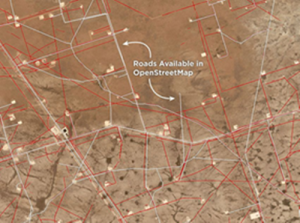
Road Detection
Upgrade your workflows with monthly road layers at scale, empowering you to update maps, track road development, and improve routing of resources.
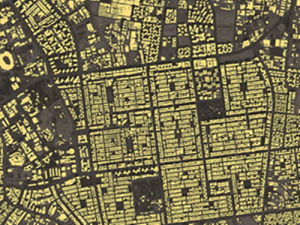
Building Detection
Get monthly building detections at scale, empowering you to update maps, track construction, and monitor land use and enforce permitting.
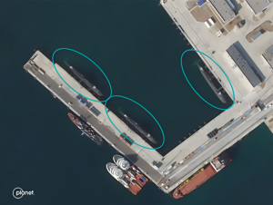
Vessel Detection
Enhance maritime datasets with daily vessel detection in ports and coastal areas. Observe patterns of life, detect illegal activities, and quantify economic activity.
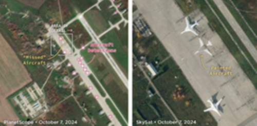
Aircraft Detection
Observe arrival and departure of aircraft on a daily basis. Monitor patterns of life, detect unusual behavior, and quantify movement of planes.
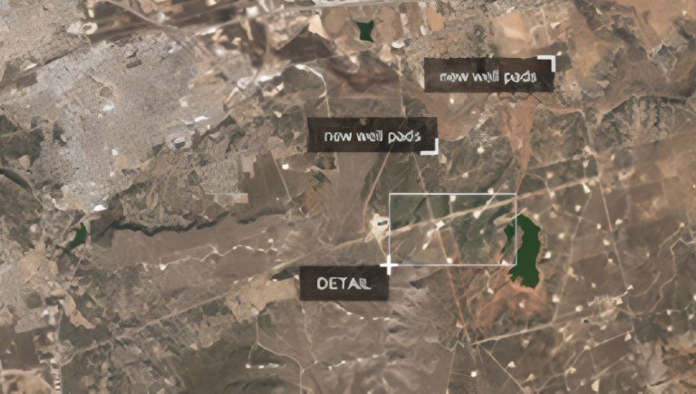
Well Pad Detection
Monitor oil and gas development across basins with monthly or weekly well pad detections. Track construction, get land acquisition insights, and streamline operations.
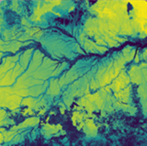
Custom Model Development
Don’t see what you need listed here? Our Professional Services team can work with you to develop a land classification model that extracts the features you are looking for.
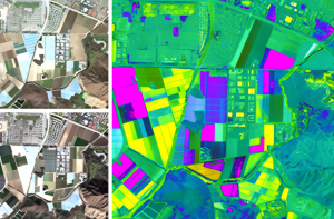
Automated Road and Building Change Detection
See where new roads are being built, and areas where there is new building construction. Derive actionable insights to deploy resources where they are needed most.
Call of Action
“See the world with unmatched clarity. Contact NexTek today to explore our satellite imagery solutions and discover how we can support your mission.”
